Lidar data processing & dtm edits
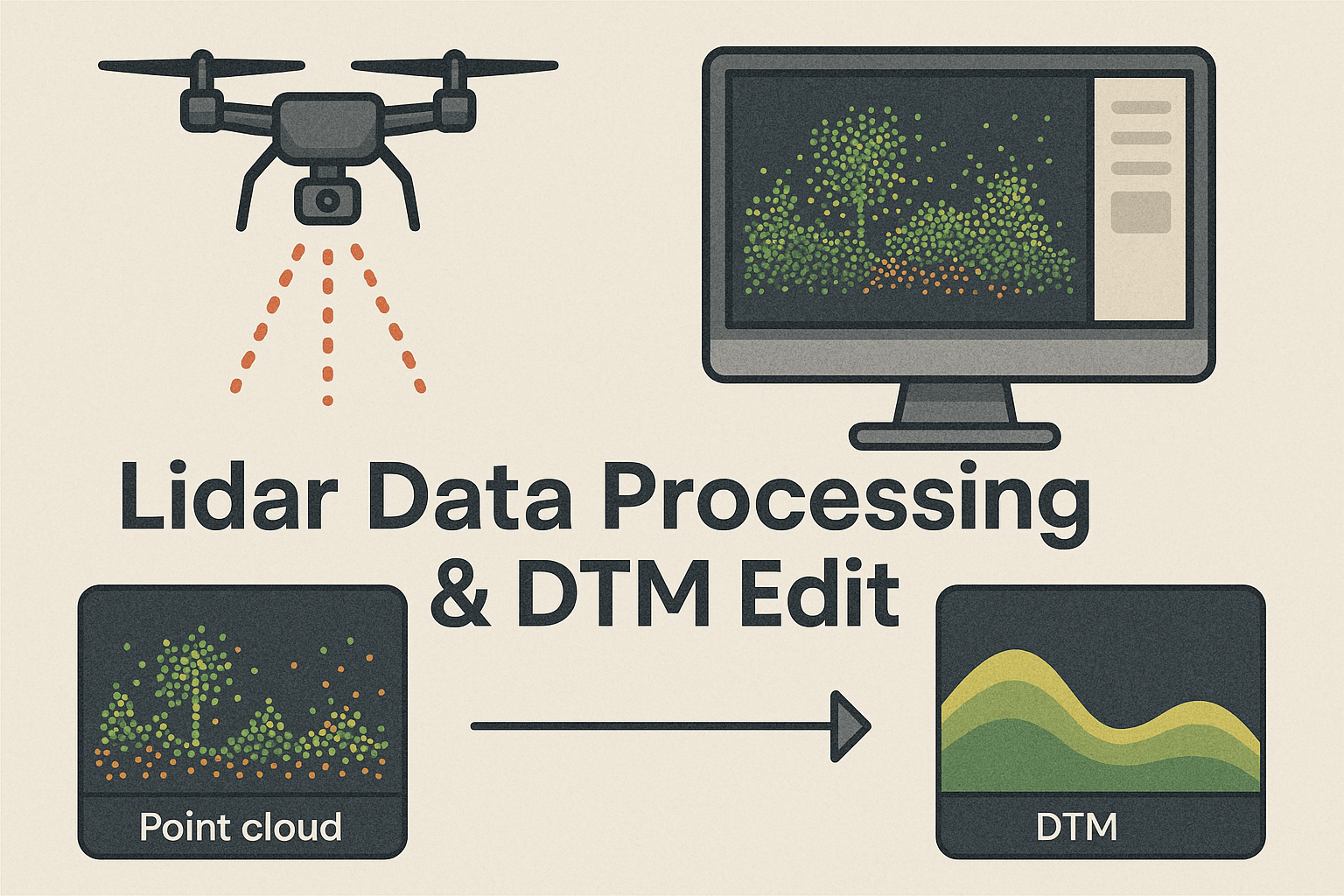
LiDAR data processing and DTM editing at Thinkaerial involves transforming raw point cloud data into accurate, high-quality terrain models. The process begins with importing and georeferencing the LiDAR data, followed by automatic and manual classification of ground and non-ground features. Noise is filtered out, and both Digital Surface Models (DSM) and Digital Terrain Models (DTM) are generated. DTM editing includes refining misclassified areas, filling voids, and applying smoothing techniques to ensure a clean, natural representation of the terrain. These processed models are then validated and exported in GIS-ready formats for use in mapping, engineering, and environmental analysis.
A glimpse into our lidar data processing & dtm edit showcase.

Master Process Which We Follow
📍 LiDAR Data Processing & 🛠 DTM Editing
-
Data Acquisition
-
Capture raw LiDAR point cloud data via drone or airborne scanning.
-
Record accurate GNSS/IMU data during the mission.
-
-
Import & Georeferencing
-
Import point cloud data into software (e.g., Global Mapper, LAStools).
-
Apply coordinate systems and align with control points if available.
-
-
Point Cloud Classification
-
Classify points into categories: ground, vegetation, buildings, water, etc.
-
Perform manual refinement to correct any misclassifications.
-
-
Noise Filtering
-
Remove outliers and erroneous returns.
-
Clean up the dataset for improved surface model accuracy.
-
-
DEM Generation
-
Generate a Digital Surface Model (DSM) from all returns.
-
Generate a Digital Terrain Model (DTM) using ground-classified points only.
-
-
Manual Terrain Editing
-
Inspect and edit misclassified or noisy ground points.
-
Correct artifacts caused by buildings, vegetation, or shadows.
-
-
Void Filling & Smoothing
-
Fill gaps in data and smooth the surface to create a clean, continuous terrain model.
-
-
Hydrological Corrections (if required)
-
Modify terrain to reflect accurate water flow paths, burn in rivers or culverts for watershed modeling.
-
-
Quality Control
-
Validate DTM accuracy using ground truth data or control points.
-
Cross-check against orthophotos or topographic references.
-
- Export & Delivery
-
DTM/DSM (GeoTIFF, ASCII Grid, LAS/LAZ)
-
Contours (SHP, DXF)
-
Classified Point Clouds
-
- Ready for use in platforms like ArcGIS, Global Mapper, or AutoCAD.